The following information is provided as a companion for "Nature at Work - Marine Ecosystems" to more thoroughly illustrate concepts discussed therein. Go back to to the article.
Image: VIMS
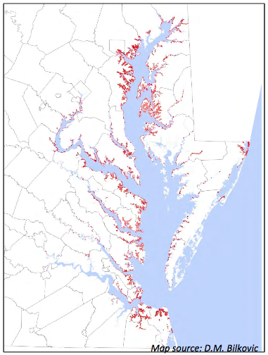
From 1944 -1977 over half the tidal marshes in the Elizabeth River were lost - More Info
Dredging in the Lynnhaven River
"Starting in about 1970, many of the small tidal marsh tributaries to the Lynnhaven River system were dredged to create accessible waterfront.
Between 1937 and 2009 approximately 214 acres of tidal marsh were converted to open water. A similar trend is seen in Broad and Linkhorn Bays". - VIMS
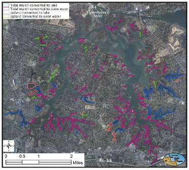
Orthorectified image of Lynnhaven River showing the areas where marsh and upland were dredged to create channels and lakes for development - VIMS
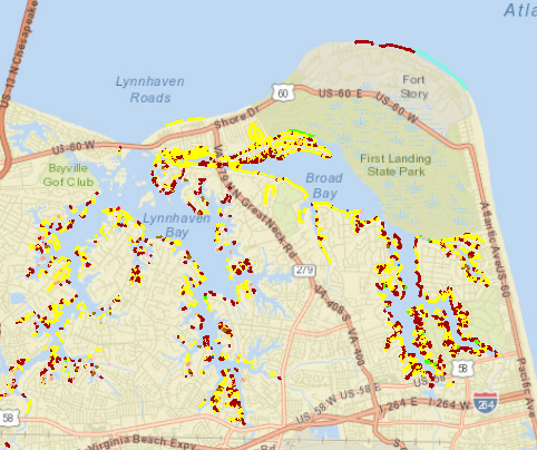
Lynnhaven River Shoreline Structures
The screenshot below of the Lynnhaven River, shows the expanse of shoreline structures. Click on the image to go to the VIMS Blue Infrastructure interactive website.
Go back to to the article "Nature at Work - Marine Ecosystems"