Click MENU Icon to Close
Image: Landsat8/NASA
Tidewater Current
Feature
SEARCH
Click MENU Icon to Close
Resources & Apps for Enjoying Nature in and around Coastal Virginia
Posted June 2016 by Carol Brighton
There are many opportunities to get out an experience nature in and around Tidewater, Virginia. From pollinator gardening in your own backyard to venturing further afield, a whole host of free resources and apps are available to help residents and visitors enjoy the great outdoors in person or virtually. Highlighted below are programs that share useful environmental info for touring, fishing, hiking, and paddling.
The Virginia Department of Health tests beach water quality. Click on the map to go the agency's interactive website. The image from 2013 portrays swimming advisories at some Chesapeake Bay beaches. Water quality is monitored once a week during summer months. In Virginia Beach testing is generally conducted on Tuesdays. Lab results from the tests are not available for 24 hours however. So beaches remain open when conditions are not favorable. By going to the VDH website, you can check if an advisory has been issued at a particular beach and review the history of advisories. If you're traveling outside of Virginia, the Natural Resources Defense Council, maintains a interactive map and database of all US beaches. The organization is currently campaigning for stricter water quality monitoring standards while the EPA is looking to ease the standards which have been in place for over 30 years. The group is also concerned that federal funding which supports water quality testing may be suspended as early as next year. You can learn more at the NRDC website. |
|
Virtual Touring Check out a natural area online before you make the trip in person with Richmond based Terrain360 virtual tours. With over 800 scenic video expeditions to choose from, the platform serves as an interactive guide for trails and waterways both near and far. You can stay close to home and explore the ghost fleet of the Potomac's Mallows Bay, traverse Appalachian trails, visit First Landing State Park, or drift down the entire length of the James and Susquehanna Rivers. Dreaming of a destination further afield? Tours are also offered of national parks like Zion and Acadia. Accompanying the video tours are detailed maps and information necessary to enjoy the sites in person. Start Touring at Terrain360. |
|
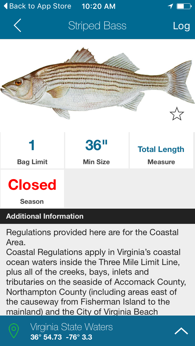
Fish Rules: New Anglers App A smartphone app is now available to recreation saltwater anglers from Maine to Texas. The free app, Fish Rules, provides images of various species for identification and lets fishermen know in real time if a fish is in season at their location, how many they can keep, minimum size, bag and vessel limit, and more. Fish Rules was co-developed by Albrey Arrington, a recreational fisherman in Jupiter, Florida, to help himself and his friends understand recreational saltwater fisheries regulations when they were out on the water fishing in the Southeast. The app uses a smartphone’s GPS and calendar to show what state or federal regulations apply to a fishing location on a specific day, making compliance with fishing regulations easy. Scott Steinback, an economist in the Social Sciences Branch at NOAA’s Northeast Fisheries Science Center in Woods Hole, Mass began working with Arrington and helped procure NOAA Fisheries funding to expand the Fish Rules app to include saltwater fishing regulations for the Northeast region, from North Carolina to Maine. “People often don’t know the regulations and are unaware of changes made year to year, or about areas closed for spawning during specific time periods. It can be hard to keep up and understand the regulations, especially if you fish at different locations,” said Scott Steinback. “Fish Rules makes it easy to comply because recreational fishermen have the most information at their fingertips, in a format that is easy to use and understand.” |
|
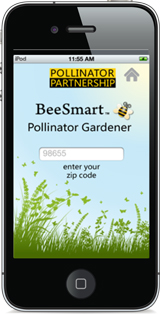
The BeeSmart Pollinator Gardener App developed by the Pollinator Partnership lets users sort through native plants by the type of pollinator that is desired as well as color preference, region based on zip code and more. |
|
The award-winning Audubon App is now FREE According to the app site, users can:
|
|
Click the Image to go to an online journal of Tidewater Paddling Tours currated by Les Parks - Maps and Beautiful Images Included |
|
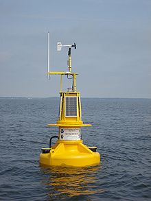
Meteorology (air and water temperature, wind direction, speed, and gust, barometric pressure, relative humidity); Currents (direction and velocity); Waves, (significant height and period, maximum height, mean wave direction, wave direction spread) and Water Quality (chlorophyll-a, dissolved oxygen, water conductivity, water salinity and turbidity). Heat and jellyfish indexes were recently added to the list of data parameters tracked. The Susquehanna buoy also had a nitrate sensor added and phosphate, water level, and acoustic fish tag tracking could be potentially implemented in the future. In addition, the system provides voice narration for sites on the Captain John Smith Chesapeake National Historic Trail, the first water-based national trail in this country. You can connect to the site toll free at 877-BUOY-BAY, visit the NOAA website, or download the smart phone app (iphone, Android)
This FREE app provides detailed information to help visitors and residents alike experience the region's natural resources and history. From biking, hiking and kayaking trails to campgrounds, bird watching and heritage sites, the app can help you identify destinations to explore. In addition to directions, pertinent information like hours of operation and fees are provided. More than 400 parks and historic sites are included in the app. Download the App: Android | Itunes |
|
DIY Solar Vintner Tour Vineyards, Wineries and Wine Distributors in the Commonwealth generating solar power Vintners, who rely on sunshine to bring fruit to the vine, are also exploiting its power to energize their indoor operations. Several vineyards and a major wine distributor have installed solar PV systems in the Commonwealth. To be included on this map contact the editor. Also check out DEQ's list of sustainibly operated wineries. |
|
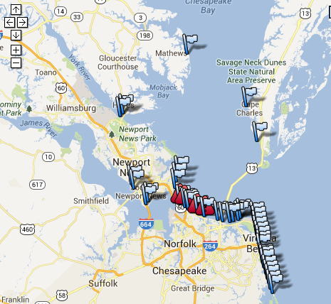
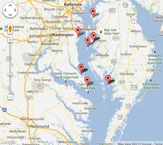
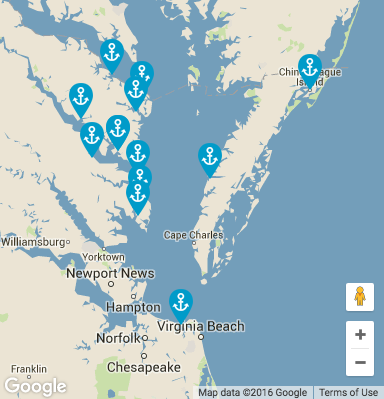
Explore the Chesapeake Bay and tributaries from the vantage of the watermen working the waterways. As crab stocks in the Bay began to plummet in the first decade of this century, restrictions were imposed on the fishery. Concerned about the livelihoods of Bay watermen, the Maryland Watermen's Association along with the National Park Service initiated a program to certify watermen to lead heritage tours.
Land and water based tours are offered at the locations indicated on the maps. Just click on either map to go to the interactive website where you can learn more about each specific tour. Participants have the opportunity to get hands on experience oyster, crab and fish harvesting. Opportunities also include visiting oyster breeding and seed operations and softshell harvesting facilities, sailing on a skipjack and kayaking local waters while learning about the unique character, history and natural resources of the area. At the end of the day, many of the tour operators send you home with some of the Bay's bounty. |
|
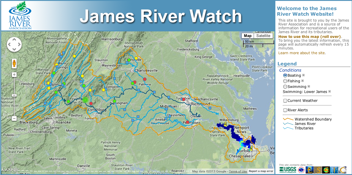
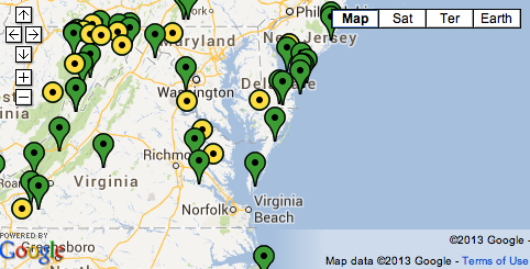
The James River Watch site provides info from numerous stations along the James River. Each circle on the map represents a station. James River Rats volunteer collect data at the various stations every week through the summer. Collected data is uploaded to the James River Watch website where users can view fishing, swimming and boating conditions. Click on the image to go to the website, then simplyclick on a station for detailed condition reports and messages . |
|
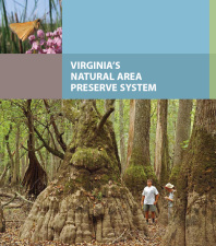
Virginia State Parks and Natural Area Preserves Click on a maps to go to the Department of Conservation and Recreation's, interactive website, or download the park and preserve guides. Parks
Preserves
 |
|
Nature Conservancy Preserves The Nature Conservancy has over 340,000 acres of protected land in the Commonwealth. Many of the Preserves are open to the public. Click the map to the left to go directly to the Conservancy's website that includes an interactive map, with info about the Preserves and directions. The North Landing River Preserve in Virginia Beach is not yet highlighted on the map, but there is a link to it under the "Places You Can Visit" section. |
|
11 refuges are located in the Chesapeake Bay region and if you want to know more about them, there’s an app for that. "The app provides a new interactive experience by encouraging refuge visitors to become modern explorers. By using their smart phones like digital butterfly nets to capture photos of the animals and plants they discover, they chronicle and share their experiences at the refuges, adding their photos to a growing global database used by citizen scientists across the globe." The app is powered by the award winning Project Noah which allows you to share wildlife encounters through its network. Click on the image to download the app.
|
|
|
|
|
LeafSnap By Columbia University, University of Maryland, and Smithsonian Institution. According to the developers, the LeafSnap free mobile app uses "visual recognition software to help identify tree species from photographs of their leaves. They contain beautiful high-resolution images of leaves, flowers, fruits, petioles, seeds and bark. The original Leafsnap currently includes trees found in the Northeastern United States and Canada, and will soon grow to include the trees of the entire continental United States."
The ODU Tree Trail, a digital interactive map that pinpoints the location of 30 types of trees sited along a path that meanders along a circular path from the Kaplan Orchid Conservatory, which has the largest orchid collection in Tidewater and is open to visitors, south to Webb Center and back. Photos along with common information and taxonomic names are included.
|
|
Ocean Data
Want to know when Great White Shark Mary Lee is off the coast? If so, the Ocearch app is for you. Ocearch sponsors scientific studies on the oceans' apex predators and is currently conducting a kickstarter campaign to finance research on migration patterns as well as mating and birth sites in New York waters. Their ultimate goal is to identify these critical locations so they can be protected. And sharks need protection. With the heinous practice of shark finning still rampantly conducted on the high seas, up to a 100 million sharks are lost every year. Ocearch collaborates with scientists from a host of renown institutions and the data they produce is open sourced. This summer research teams will endeavor to tag juvenile great white sharks in New York waters while scientists in North Carolina will try to tag female sand tiger sharks. Whale Alert - Whales are slow moving and vulnerable to ship strikes, especially since they often feed and migrate in or near shipping lanes. With the goal of reducing ship strikes, Whale Alert was developed by a group of government agencies, academic institutions, non-profits, shipping companies and other interested parties led by NOAA’s Office of National Marine Sanctuaries. If adopted by mariners and citizens alike, it could be a useful tool to alert ships, rescuers and researchers of the great mammals activities along the coast. The TURT app developed at Loma Linda University was designed to unite researchers and tourists in the effort to protect endangered sea turtles. According to the product description, "this application allows citizen-scientists to assist researchers in collecting sea turtle sightings and photographs. Researchers can then use these sightings and photographs to identify individual turtles through Photo ID programs or determine general sea turtle sightings rates for a particular area. Users will be able to see where sea turtle sightings have been logged from all over the world through turtle symbols presented on the map." The app is suported by both Iphone and Android smart phones.
Wave Riding Scientists - Surfers could soon be collecting valuable ocean data Smartfin, an innovative endeavor supported by NYC based Lost Bird Project, will allow surfers to collect and share ocean data every time they take to the water. Sensors embedded in a fin will transmit data in near real-time on water ph, salinity, temperature and detailed wave characteristics. With wireless charging on the horizon, the sensor system can be energized without removal from the board. The group is coordinating with the Scripps Institute of Oceanography to validate the technology. Learn more by watching this informative video by Great Big Story. |
Check the Archive for Previous Posts
All Rights Reserved: Disclaimer
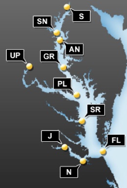
 Chesapeake Bay "smart buoys" give real-time wind and weather information

 Website Reports Conditions along the James River


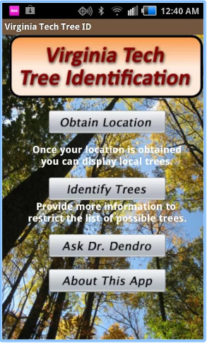 Virginia Tech Tree Id
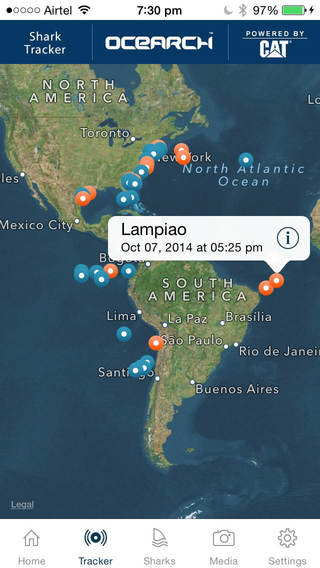 The
The